
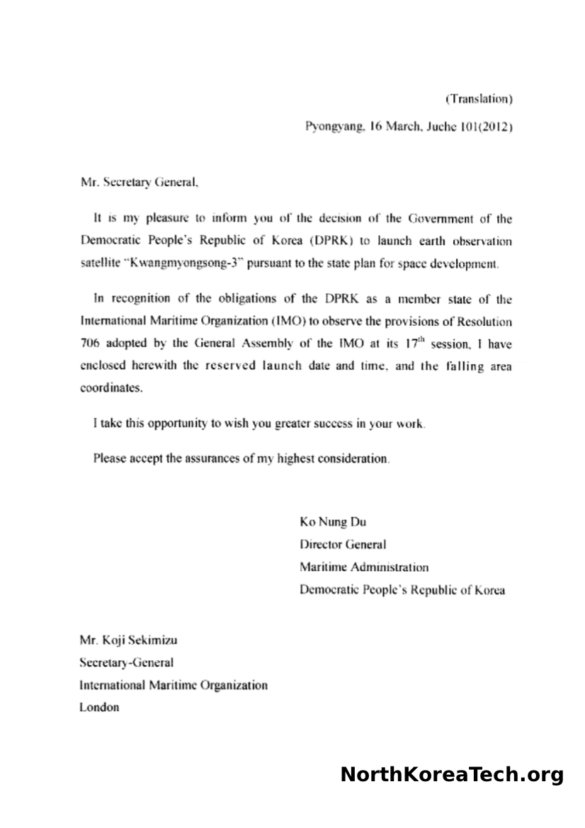
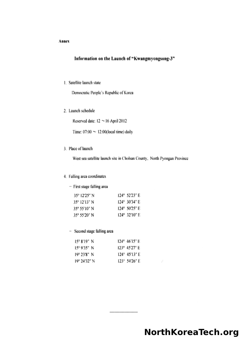
North Korea’s Unha-3 rocket, scheduled for launch next month, will drop to earth in two stages off the western coast of South Korea and to the east of Luzon Island in the Philippines, according to documents submitted by the country to the International Maritime Organization.
 The documents, obtained by NorthKoreaTech.org, were sent to the IMO’s London headquarters from the DPRK’s embassy in the U.K. They carried the name of “Ko Nung Do,” who is identified as director general of the DPRK’s Maritime Administration.
Some of the information restates what has already been disclosed by the country: that the launch would take place from a satellite launch site in Cholsan County of North Pyongan Province during a five day period from April 12th to 16th.
They also include some new information: that the launch could take place anytime between 7am and noon local time (2200 to 0300 GMT); and include the coordinates of the projected drop zones for the two-stage rocket.
The rocket’s path takes it over the western tip of South Hwanghae province in North Korea then over the South Korean islands of Baegryeong-do, Daecheong-do and Socheong-do, and then across open water until it passes between Japan’s Miyako and Ishigaki islands before heading further south.
The details were provided to the IMO so that the international organization can warn shipping traffic to stay clear from the two areas.
A similar notice is expected to be provided by the International Civil Aviation Organization to aircraft.
North Korea’s last rocket launch in 2009 was from the Tonghae Satellite Launching Ground in the east of the country and had the rocket flying over Japan en route towards the Pacific Ocean.
Many countries have urged North Korea to halt the rocket launch, which is widely seen as a long-range ballistic missile test and not a satellite launch. Japan’s defense minister has publicly said he may order the deployment of Patriot missiles to the Okinawan islands so that the rocket can be shot down should it fail and pose a danger to Japan.
Below you can see copies of the letter and an embedded map illustrating the two zones.


View Larger Map

